I’ve recently discovered the National Library of Scotland (NLS), a repository of ordinance survey maps that help me with accuracy in my historical novels.
I’m the kind of writer who likes to get a Google map of the area I’m writing about, or better yet, to actually go there and walk the streets. What usually happens is that I use the map (and other online info) extensively, while I’m writing a book. Then, after the book is published, I somehow manage to go to that place, and walk around pointing out to myself what I got right and what I got wrong. Either way, I always treat myself to a drink at the nearest pub afterwards, such as the Ring of Bells in Taunton, UK.
 .
.
While I have been working on my Oliver & Jack series, I discovered the online National Library of Scotland, and their ordinance survey maps that go all the way back to 1842. I was so estatic that I nearly jumped up and shouted out loud: Hallelujah! Or Eureka! And I almost cried.
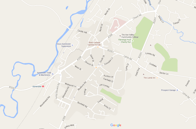
For example, what I had been working with while writing In Axminster Workhouse, was a map kindly provided by Google Maps. It looked like this:

Google Maps is very useful for a basic overview of the location one is writing about. The obvious problem is, all those highways and byways and railroads don’t exist in the year 1846!
Then, every now and then, I would come across something that looked fairly detailed, but was so small that I couldn’t read any of the text. It was a tantalizing discovery that would do me no good at all! It would look like this:

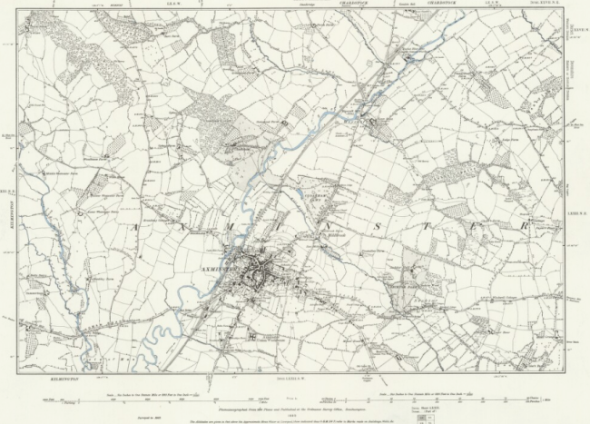
Then, at one point, there was a mention of the OS (ordinance survey) map collection; these maps were made following the Tithe Commutation Act of 1836 (near as I can figure it), which meant that farmers who rented property had to pay tithes based not on the value of the crops, but on how much their land was worth. (Also, thanks goes to Bill Bryson and his marvelous book At Home: A Short History of Private Life for untangling so much about British history.)
So instead of a teeny, tiny unreadable map of wherever (in this case, Axminster, UK), I could look at the map as a whole and get the spacial relationship between the location and the surrounding areas.

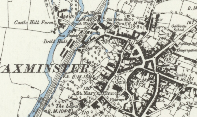
Or I could zoom in and get all the teeny, tiny but very important details:

And I don’t know about you, but I get pretty excited when I can give my writing a sense of realism; the level of detail on the NLS allows me to do just that. So if you’re writing a historical novel, you should check it out!